MTB tour Rittner Hochplateau
Short description
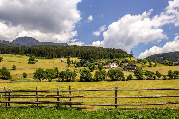
Cycling on the Ritten high plateau.
Description
Anyone who thinks that there are no other elevations on a high plateau is mistaken. Proof of this is this cycle tour on the Ritten, where even fit bikers are guaranteed to work up a sweat.
Starting point of the tour
School car park in Oberinn
Destination of the tour
Wangen
Route description
The Oberinn-Wangen tour in the south of South Tyrol starts at the school car park in Oberinn and is already a little steep at the beginning. Follow the blue/white marked trail no. 32a past terraced houses in the direction of Pöchlerhöfe. There, a goods road branches off into the forest below the farm. Here you cycle steeply up to the Gaughof farm and then on a bumpy gravel road, first downhill and then uphill to the tarmac road to Wangen.
Cyclists take road 4 through the village and, after a short rest, begin the descent back to Oberinn. They take the municipal road no. 4 and cycle or push themselves uphill to the Alpenrose snack station and the wooden bridge over the Wangen stream. Immediately afterwards, bikers take trail no. 4 again and return to Oberinn through a steep section of forest
Trail signs
32a, 4
Equipment
Mountain bike, helmet, wind and rain protection, sunglasses, air pump
Public transport
Trains stop at Bozen railway station, bus connection Bozen-Ritten
Directions
Brenner motorway A22, exit Bozen Nord, direction Ritten/Renon, Oberinn
Parking
School car park in Oberinn
Tip by the author
Type of trail
Length 8.6 km
Author
Editorial office south-tirol.com